

Mapping Drone
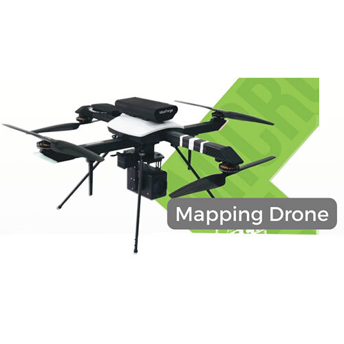

Mapping Drone Specification
- Operate Method
- Automatic
- Material
- Carbon Fiber
- Color
- Black
- Usage
- Survey
- Product Type
- Mapping Drone
- Weight
- 2 Kilograms (kg)
Mapping Drone Trade Information
- Minimum Order Quantity
- 1 Piece
- Supply Ability
- 100 Pieces Per Week
- Delivery Time
- 7 Days
About Mapping Drone
Experience ace performance with our top-rated Mapping Drone, crafted from robust carbon fiber and weighing just 2 kilograms. Designed in dazzling black, this automatic marvel is ideal for survey operations, making it a sterling choice for professionals across India. As a leading supplier, distributor, importer, service provider, and trader, we guarantee a bargain deal. Order today to access a new era in mapping technology and enhance your workflow effortlessly.
Mapping Drone: Commercial Uses and Key Features
The Mapping Drone is engineered for a spectrum of commercial applications, including land surveying, construction site analysis, and agricultural mapping. Standout features include automatic operation and lightweight carbon fiber build for optimal maneuverability and durability. Its deep-black finish ensures understated professionalism. This drone finds application across industries like real estate, mining, and environmental management, making it indispensable for modern survey teams.
Supply Ability and Domestic Market Reach
Our supply is streamlined for prompt service across India, with extensive distribution networks minimizing freight expenditure and assuring timely delivery. We support generous sample policy options to facilitate informed purchase decisions. The Mapping Drone is consistently available in large volumes, ensuring continuous project deployment without delays. We cater to the main domestic market, and guarantee reliable support for all your procurement and logistical needs.
FAQs of Mapping Drone:
Q: How do I operate the Mapping Drone for surveying tasks?
A: The Mapping Drone features automatic operation, allowing users to program routes and let the device handle flight and data capture. This ensures accurate, efficient surveys with minimal manual intervention.Q: What benefits does carbon fiber construction offer?
A: Carbon fiber makes the drone lightweight and exceptionally durable, enabling longer flight times, increased payload capacity, and resilience in challenging environments.Q: When can I expect delivery after placing an order?
A: Delivery timelines vary depending on your location within India and prevailing freight conditions, but our streamlined supply chain ensures prompt and reliable shipping.Q: Where can the Mapping Drone be applied professionally?
A: This drone is suitable for surveying agricultural land, construction projects, mining sites, real estate development, and environmental analysis, making it versatile across numerous industries.Q: What is the sample policy for the Mapping Drone?
A: We offer a responsive sample policy, allowing clients to assess features and operation before committing to significant expenditure, ensuring complete satisfaction with your purchase.Q: How does automatic operation enhance usage efficiency?
A: Automatic operation simplifies usage, reduces human error, boosts productivity, and enables precise data collection during surveys.- Minimum Order Quantity
- 1 Piece
- Supply Ability
- 100 Pieces Per Week
- Delivery Time
- 7 Days
 Get Latest Price
Tell us about your requirement

Price:
Quantity
Select Unit
- 50
- 100
- 200
- 250
- 500
- 1000+
Additional detail
Mobile number
Email

More Products in SURVEYING SOLUTIONS Category
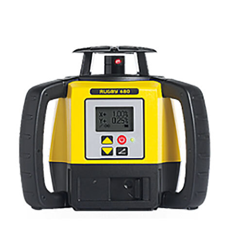
ROTATIONAL LASER
Minimum Order Quantity : 1 Unit
Usage : Survey
Color : Yellow
Product Type : ROTATIONAL LASER
Operate Method : Automatic
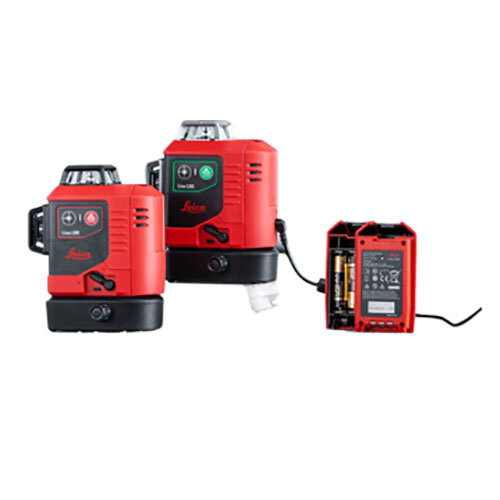
LINE LASER
Minimum Order Quantity : 1 Piece
Usage : Survey
Color : Red
Product Type : LINE LASER
Operate Method : Automatic
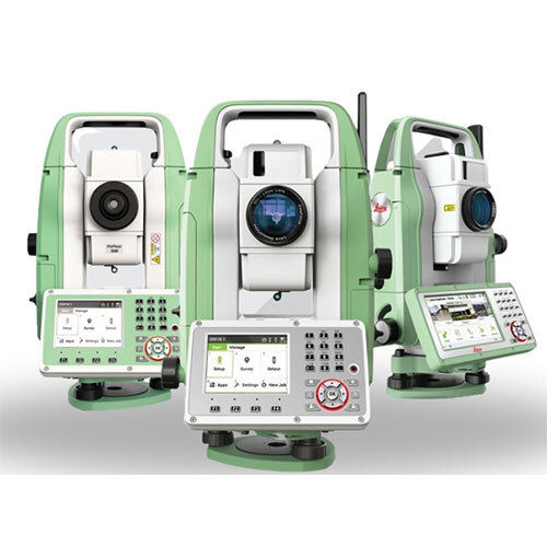
SURVEYING SOLUTIONS
Minimum Order Quantity : 1 Piece
Usage : Survey
Color : Green And White
Product Type : SURVEYING SOLUTIONS
Operate Method : Automatic

Quick Inquiry


Contact Details
K. K. SALES
GST : 24ADHPA9722H1ZR
GST : 24ADHPA9722H1ZR
No. B-14&15, Circle-b, Complex, Near Pakwan2, Sg Highway, Bodakdev, Ahmedabad - 380015, Gujarat, India
Phone :07971549272

 |
K. K. SALES
All Rights Reserved.(Terms of Use) Developed and Managed by Infocom Network Private Limited. |
